
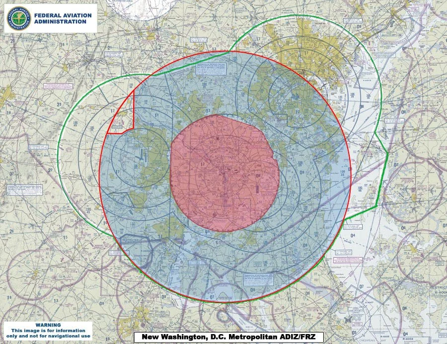
Washington D.C. Special Flight Rules Area
This is an area of airspace where the ready identification, location, and control of aircraft is required in the interests of national security. Laterally, the airspace extends 30 nautical miles from the DCA VOR/DME and vertically from the surface up to, but not including, flight level 180. A special SFRA flight plan must be filed to enter or fly within this airspace. The SFRA also includes the Flight Restricted Zone (FRZ) which is limited to regularly scheduled air carriers, approved law enforcement, government, and air ambulance operations.